
Remote sensing techniques are based on many different procedures and instruments depending on the proposed objective. In the case of the research of atmospheric components, such as aerosol, water vapor, atmospheric gases, etc., data from ground-based sun-photometers or radiometers, satellite radiometer sensors, LIDARs, ceilometers, RADARs, etc., are required.
Our calibration platform of Valladolid is an AERONET station but it is also equipped with other instruments for atmospheric studies: a ceilometer, a sky camara and several broadband radiometers for the measurement of solar and UV radiation components. Taking into account our research on aerosols and other atmospheric components (i.e. water vapor), data provided by satellite sensors are required as a necessary complement, due to the large spatial coverage. We have also carried out validation studies: OMI aerosol, water vapor and radiation data; MODIS aerosol and water vapor, and GOME2. These sensors are the most frequently used by our group.
We are currently involved in two calibration/validation (CAL/VAL) activities with the European Space Agency, both leaded by the Andøya Space Center: the project ALIVO ALOMAR is a CAL/VAL activity related to the ADM-Aeolus sensor; and ALIVO S5P‘Arctic is related to the Sentinel-5 Precursor.
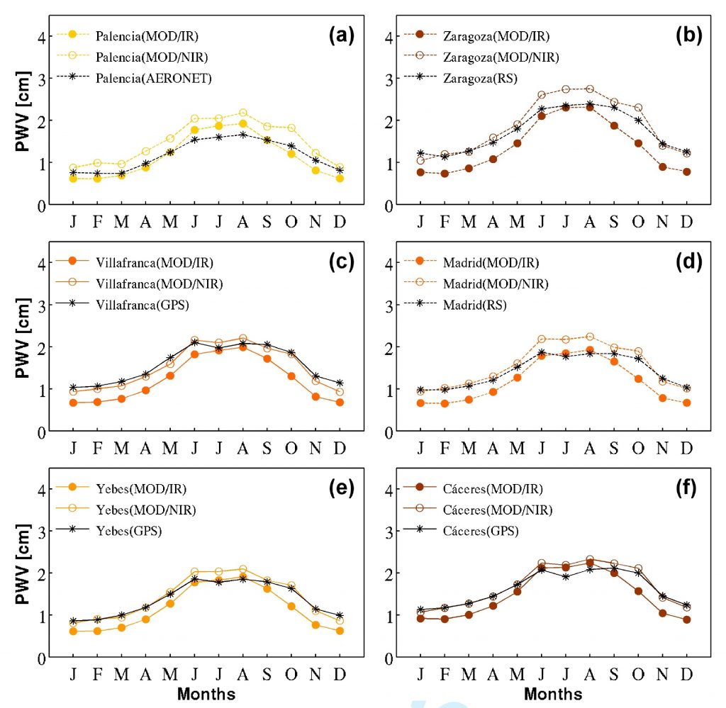
PWV annual cycle (multi-annual 2002-2008) from MODIS IR/NIR and
ground-based GPS/radiosounding(RS)/AERONET) at:
(a) Palencia, (b) Zaragoza, (c) Villafranca, (d) Madrid, (e) Yebes and (f) Cáceres.
From Bennouna et al., 2013. DOI:10.1002/qj.2080