
Mission
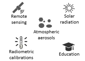 |
The Atmospheric Optics Group of Valladolid University (GOA-UVa) is involved in the study of atmospheric components, mainly aerosols, with optical methods. The GOA calibration facility is devoted to radiometric calibration of optical instrumentations such as photometers, and it is part of the AERONET-Europe Central Facility, partially funded by the European Union. As a university group, our researchers carry out educational and training activity (graduate, master and PhD thesis). In this site you can find information about the work of the group, members, research lines, publications, projects, vacancies, etc. |
Latests 5 Publications
2023
Sara Herrero-Anta; Roberto Román; David Mateos; Ramiro González; Juan Carlos Antuña-Sánchez; Marcos Herreras-Giralda; Antonio Fernando Almansa; Daniel González-Fernández; Celia Herrero del Barrio; Carlos Toledano; Victoria Eugenia Cachorro; Ángel Máximo de Frutos
Retrieval of aerosol properties from zenith sky radiance measurements Journal Article
In: Atmospheric Measurement Techniques, vol. 16, no. 19, pp. 4423–4443, 2023.
@article{Herrero-Anta2023,

title = {Retrieval of aerosol properties from zenith sky radiance measurements},

author = {Sara Herrero-Anta and Roberto Román and David Mateos and Ramiro González and Juan Carlos Antuña-Sánchez and Marcos Herreras-Giralda and Antonio Fernando Almansa and Daniel González-Fernández and Celia Herrero del Barrio and Carlos Toledano and Victoria Eugenia Cachorro and Ángel Máximo de Frutos},

url = {https://amt.copernicus.org/articles/16/4423/2023/},

doi = {10.5194/amt-16-4423-2023},

year  = {2023},

date = {2023-10-09},

urldate = {2023-10-09},

journal = {Atmospheric Measurement Techniques},

volume = {16},

number = {19},

pages = {4423–4443},

abstract = {This study explores the potential to retrieve aerosol properties with the GRASP algorithm (Generalized Retrieval of Atmosphere and Surface Properties) using as input measurements of zenith sky radiance (ZSR), which are sky radiance values measured in the zenith direction, recorded at four wavelengths by a ZEN-R52 radiometer. To this end, the ZSR measured at 440, 500, 675 and 870?nm by a ZEN-R52 (ZSRZEN), installed in Valladolid (Spain), is employed. This instrument is calibrated by intercomparing the signal of each channel with coincident ZSR values simulated (ZSRSIM) at the same wavelengths with a radiative transfer model (RTM). These simulations are carried out using the GRASP forward module as RTM and the aerosol information from a co-located CE318 photometer belonging to AERONET (AErosol RObotic NETwork) as input. The dark signal and the signal dependence on temperature are characterized and included in the calibration process. The uncertainties for each channel are quantified by an intercomparison with a co-located CE318 photometer, obtaining lower values for shorter wavelengths; they are between 3?% for 440?nm and 21?% for 870?nm. The proposed inversion strategy for the aerosol retrieval using the ZSRZEN measurements as input, i.e. so-called GRASP-ZEN, assumes the aerosol as an external mixture of five pre-calculated aerosol types. A sensitivity analysis is conducted using synthetic ZSRZEN measurements, pointing out that these measurements are sensitive to aerosol load and type. It also assesses that the retrieved aerosol optical depth (AOD) values in general overestimate the reference ones by 0.03, 0.02, 0.02 and 0.01 for 440, 500, 675 and 870?nm, respectively. The calibrated ZSRZEN measurements, recorded during 2.5 years at Valladolid, are inverted by the GRASP-ZEN strategy to retrieve some aerosol properties like AOD. The retrieved AOD shows a high correlation with respect to independent values obtained from a co-located AERONET CE318 photometer, with determination coefficients (r2) of 0.86, 0.85, 0.79 and 0.72 for 440, 500, 675 and 870?nm, respectively, and finding uncertainties between 0.02 and 0.03 with respect to the AERONET values. Finally, the retrieval of other aerosol properties, like aerosol volume concentration for total, fine and coarse modes (VCT, VCF and VCC, respectively), is also explored. The comparison against independent values from AERONET presents r2 values of 0.57, 0.56 and 0.66 and uncertainties of 0.009, 0.016 and 0.02?µm3?µm?2 for VCT, VCF and VCC, respectively},

keywords = {},

pubstate = {published},

tppubtype = {article}

}
Añel, J. A.; I. Cnossen; J. C. Antuña-Marrero; G. Beig; M. K. Brown; E. Doornbos; R. García; L. Gray; D. R. Marsh; S. Osprey; M. G. Mlynczak; S. M. Mutschler; P. Pišoft; V. Sofieva; P. Šácha; L. de la Torre; S.R. Zhang
Documenting the Impacts of Climate Change on the Middle and Upper Atmosphere and Atmospheric Drag of Space Objects Journal Article
In: SPARC Newsletter, no. 61, pp. 22, 2023, ISSN: 1245-4680.
@article{Añel2023,

title = {Documenting the Impacts of Climate Change on the Middle and Upper Atmosphere and Atmospheric Drag of Space Objects},

author = {Añel, J. A. and I. Cnossen and J. C. Antuña-Marrero and G. Beig and M. K. Brown and E. Doornbos and R. García and L. Gray and D. R. Marsh and S. Osprey and M. G. Mlynczak and S. M. Mutschler and P. Pišoft and V. Sofieva and P. Šácha and L. de la Torre and S.R. Zhang},

url = {https://www.sparc-climate.org/wp-content/uploads/sites/5/2023/08/SPARCnewsletter61Jul23.pdf},

issn = {1245-4680},

year  = {2023},

date = {2023-07-01},

journal = {SPARC Newsletter},

number = {61},

pages = {22},

keywords = {},

pubstate = {published},

tppubtype = {article}

}
V. Salgueiro; J. L. Guerrero-Rascado; M. J. Costa; R. Román; A. Cazorla; A. Serrano; F. Molero; M. Sicard; C. Córdoba-Jabonero; D. Bortoli; A. Comerón; F. T. Couto; M. Á. López-Cayuela; D. Pérez-Ramírez; M. Potes; J. A. Muñiz-Rosado; M. A. Obregón; R. Barragán; D. C. F. S. Oliveira; J. Abril-Gago; R. González; C. Gíl-Díaz; I. Foyo-Moreno; C. Muñoz-Porcar; M. J. Granados-Muñoz; A. Rodríguez-Gómez; M. Herreras-Giralda; J. A. Bravo-Aranda; C. V. Carvajal-Pérez; A. Barreto; L. Alados-Arboledas
In: Remote Sensing of Environment, vol. 295, pp. 113684, 2023, ISSN: 0034-4257.
@article{Salgueiro2023,

title = {Characterization of Tajogaite volcanic plumes detected over the Iberian Peninsula from a set of satellite and ground-based remote sensing instrumentation},

author = {V. Salgueiro and J. L. Guerrero-Rascado and M. J. Costa and R. Román and A. Cazorla and A. Serrano and F. Molero and M. Sicard and C. Córdoba-Jabonero and D. Bortoli and A. Comerón and F. T. Couto and M. Á. López-Cayuela and D. Pérez-Ramírez and M. Potes and J. A. Muñiz-Rosado and M. A. Obregón and R. Barragán and D. C. F. S. Oliveira and J. Abril-Gago and R. González and C. Gíl-Díaz and I. Foyo-Moreno and C. Muñoz-Porcar and M. J. Granados-Muñoz and A. Rodríguez-Gómez and M. Herreras-Giralda and J. A. Bravo-Aranda and C. V. Carvajal-Pérez and A. Barreto and L. Alados-Arboledas},

url = {https://www.sciencedirect.com/science/article/pii/S0034425723002353},

doi = {https://doi.org/10.1016/j.rse.2023.113684},

issn = {0034-4257},

year  = {2023},

date = {2023-06-13},

urldate = {2023-01-01},

journal = {Remote Sensing of Environment},

volume = {295},

pages = {113684},

abstract = {Three volcanic plumes were detected during the Tajogaite volcano eruptive activity (Canary Islands, Spain, September–December 2021) over the Iberian Peninsula. The spatiotemporal evolution of these events is characterised by combining passive satellite remote sensing and ground-based lidar and sun-photometer systems. The inversion algorithm GRASP is used with a suite of ground-based remote sensing instruments such as lidar/ceilometer and sun-photometer from eight sites at different locations throughout the Iberian Peninsula. Satellite observations showed that the volcanic ash plumes remained nearby the Canary Islands covering a mean area of 120 ± 202 km2 during the whole period of eruptive activity and that sulphur dioxide plumes reached the Iberian Peninsula. Remote sensing observations showed that the three events were mainly composed of sulphates, which were transported from the volcano into the free troposphere. The high backscatter-related Ångström exponents for wavelengths 532–1064 nm (1.17 ± 0.20 to 1.40 ± 0.24) and low particle depolarization ratios (0.08 ± 0.02 to 0.09 ± 0.02), measured by the multi-wavelength Raman lidar, hinted at the presence of spherical small particles. The layer aerosol optical depth at 532 nm (AODL532) obtained from lidar measurements contributed between 49% and 82% to the AERONET total column AOD at 532 nm in event II (11–13 October). According to the GRASP retrievals, the layer aerosol optical depth at 440 nm (AODL440) was higher in all sites during event II with values between 0.097 (Badajoz) and 0.233 (Guadiana-UGR) and lower in event III (19–21 October) varying between 0.003 (Granada) and 0.026 (Évora). Compared with the GRASP retrievals of total column AOD at 440 nm, the AODL440 had contributions between 21% and 52% during event II. In the event I (25–28 September), the mean volume concentrations (VC) varied between 5 ± 4 ?m3cm?3 (El-Arenosillo/Huelva) and 17 ± 10 ?m3cm?3 (Guadiana-UGR), while in event II this variation was from 11 ± 7 ?m3cm?3 (Badajoz) to 27 ± 10 ?m3cm?3 (Guadiana-UGR). Due to the impact of volcanic events on atmospheric and economic fields, such as radiative forcing and airspace security, a proper characterization is required. This work undertakes it using advanced instrumentation and methods.},

keywords = {},

pubstate = {published},

tppubtype = {article}

}
Javier Montero-Martín; Manuel Antón; José Manuel Vaquero; Roberto Román; Javier Vaquero-Martinez; Alejandro J. P. Aparicio; Arturo Sanchez-Lorenzo
Reconstruction of daily global solar radiation under all-sky and cloud-free conditions in Badajoz (Spain) since 1929 Journal Article
In: International Journal of Climatology, vol. n/a, no. n/a, 2023.
@article{Montero-Martín2023,

title = {Reconstruction of daily global solar radiation under all-sky and cloud-free conditions in Badajoz (Spain) since 1929},

author = {Javier Montero-Martín and Manuel Antón and José Manuel Vaquero and Roberto Román and Javier Vaquero-Martinez and Alejandro J. P. Aparicio and Arturo Sanchez-Lorenzo},

url = {https://rmets.onlinelibrary.wiley.com/doi/abs/10.1002/joc.8042},

doi = {https://doi.org/10.1002/joc.8042},

year  = {2023},

date = {2023-02-16},

journal = {International Journal of Climatology},

volume = {n/a},

number = {n/a},

abstract = {Abstract This work analyses the long-term temporal variability of the annual and seasonal series of reconstructed global solar radiation for both all-sky and cloud-free conditions in Badajoz (Spain) over the 1929–2015 period. Specifically, daily values of global horizontal irradiation (GHI) for all-sky cases are derived from a semiempirical method based on the relationship between the cloud modification factor and sunshine duration records. Additionally, cloud-free situations are selected using cloud cover (CC) information recorded by surface observations. Regarding GHI linear trends for all-sky conditions, three periods are clearly identified: during the 1929–1950 period, there is a positive and statistically significant trend of +4.18?W·m?2·decade?1. It is followed by a significant dimming with a trend of ?3.72?W·m?2·decade?1 between 1951 and 1984. GHI levels increase again from 1985 to 2015 with a statistically significant trend of +2.04?W·m?2·decade?1. The seasonal trends are found to be statistically significant only in summer for all the three subperiods. With the goal to find out the possible causes of the reconstructed GHI trends, the temporal variability of the CC was also analysed. It was observed that CC has a statistically significant negative trend between 1985 and 2015 which may partially explain the GHI increase shown for this period. In contrast, not statistically significant trends were found in the annual and seasonal CC series before 1985. The long-term evolution of the GHI under cloud-free conditions exhibits the same pattern as all-sky conditions: an increase during 1929–1950, followed by a decrease in 1951–1984 and then a new increase from 1985 to 2015. Therefore, the positive (negative) linear trends in GHI reported in this study could be partially related to a decrease (increase) in the aerosol load during the analysed three subperiods.},

keywords = {},

pubstate = {published},

tppubtype = {article}

}
Celia Herrero del Barrio; David Mateos; Roberto Román; Ramiro González; Sara Herrero-Anta; Daniel González-Fernández; Abel Calle; Carlos Toledano; Victoria Eugenia Cachorro; Ángel Máximo De Frutos Baraja
Analysis of Daytime and Night-Time Aerosol Optical Depth from Solar and Lunar Photometry in Valladolid (Spain) Journal Article
In: Remote Sensing, vol. 15, no. 22, 2023, ISSN: 2072-4292.
@article{rs15225362,

title = {Analysis of Daytime and Night-Time Aerosol Optical Depth from Solar and Lunar Photometry in Valladolid (Spain)},

author = {Celia Herrero del Barrio and David Mateos and Roberto Román and Ramiro González and Sara Herrero-Anta and Daniel González-Fernández and Abel Calle and Carlos Toledano and Victoria Eugenia Cachorro and Ángel Máximo De Frutos Baraja},

url = {https://www.mdpi.com/2072-4292/15/22/5362},

doi = {10.3390/rs15225362},

issn = {2072-4292},

year  = {2023},

date = {2023-01-01},

urldate = {2023-01-01},

journal = {Remote Sensing},

volume = {15},

number = {22},

abstract = {Aerosol optical depth (AOD) at night-time has become a hot topic in recent years due to the development of new instruments recording accurate ground-based lunar irradiance measurements, and the development of calibration methods and extraterrestrial irradiance models adapted to lunar photometry. This study uses all daytime and night-time AOD data available at Valladolid (Spain) from October 2016 to March 2022 in order to analyze its behavior and the added contribution of night data. The annual, monthly and daily AOD evolution is studied comparing daytime and night-time values and checking the correlation between them. For this purpose, the daily averages are computed, showing an annual pattern, with low AOD values throughout the year (mean value of AOD at 440 nm: 0.122), where winter months have the lower and summer the higher values, as observed in previous studies. All these AOD values are modulated by frequent desert dust events over the Iberian Peninsula, with a strong influence on daily and monthly mean values in February and March, where the strongest desert outbreaks occurred. The added new data confirm these results and the good correlation between daytime and night-time data. Also, a complete daily evolution is shown, observing that AOD and Ångström exponent (AE) mean values vary by only ±0.02 in 24 h, with a maximum value at 06:00 UTC and minimum at 18:00 UTC for both parameters.},

keywords = {},

pubstate = {published},

tppubtype = {article}

}