
Objectives
-
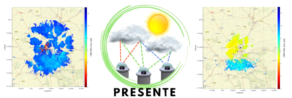
Install and keep operational a network of all-sky cameras distributed throughout the urban area of Valladolid (Spain) and its surroundings, in order to capture, store, and process digital images of the sky above the city. A total of 25 cameras will be installed to cover the entire area, keeping a distance of about 2 km between them to enable stereoscopic techniques.
-
Develop and implement a set of algorithms and methods capable of producing, from the digital sky images, a three-dimensional map of the clouds and their properties over the city in near real time, as well as a short-term forecast of this 3D cloud map. The aim is to detect clouds in the various sky images and, by knowing their position in the images captured by different cameras, determine their height and location over the city and its surroundings. This will make it possible to generate a 3D cloud map with high spatial resolution. The temporal evolution of this map will be used to predict its future state, and the use of artificial intelligence algorithms for cloud detection and prediction will also be explored.
-
Compute the solar radiation that reaches different points in the city using a 3D radiative transfer model capable of assimilating the predicted 3D cloud map obtained in Objective 2. The Mystic/libRadtran model will be used, and to validate the method, the results will be compared with measurements taken by pyranometers installed across the city.
-
Disseminate the results and products derived from the project to the scientific community and to society at large. In addition to publishing the results in scientific journals and general media, a mobile application will be developed to visualize the images and solar resource predictions.
Overview
To achieve an environmentally sustainable situation through an ecological transition, a shift toward a new energy model is required. Two key elements in this transition are the maximum integration of renewable energy sources and improved energy efficiency. This is especially important in urban environments, where energy consumption accounts for two thirds of global use. In the case of solar renewable energy, an effective way to manage consumption is to know in advance the solar resource that will be available and, based on that prediction, decide whether energy should be used at that moment, thereby optimizing overall consumption.
The solar radiation reaching a specific point can be calculated with a radiative transfer model (RTM) as long as the relevant atmospheric components are known. The most significant among them are clouds and aerosols. Aerosols tend to be distributed more homogeneously, their concentration and properties change slowly over time, and their influence on global solar radiation is comparatively smaller. Clouds, however, display much greater temporal and spatial variability and usually have a stronger impact on solar radiation, sometimes reducing or increasing it drastically.
The main goal of this work is to develop and apply a new methodology that is scalable and functional for short-term prediction of solar energy resources at any photovoltaic or thermal installation within a city. This approach can greatly improve energy efficiency in these environments. Although the methodology will initially be implemented in a specific city (Valladolid, Spain) for practical reasons, it is designed to be adaptable to any other urban setting.
To achieve this goal, an experimental setup will first be deployed. A total of 25 sky cameras will be installed throughout Valladolid to ensure full coverage of the city while maintaining a spacing of about 2 km between cameras. With this system, a set of algorithms will be developed to detect clouds from the images captured by the cameras. By using images taken at the same moment from different cameras, cloud height can be estimated through stereoscopy. This method will allow each cloud to be located in three dimensions. By observing changes in this 3D map over time, a short-term forecast of the map can be produced. An additional approach will involve predicting the sky images with an artificial intelligence algorithm to obtain the 3D cloud map. The predicted map, together with various atmospheric parameters such as aerosol optical thickness obtained from other sources, will then be used as input for a 3D RTM model (Mystic/libRadtran) to calculate the solar radiation reaching different points in the city. These results will be validated with independent measurements taken by four pyranometers that will be installed at several locations.
The socioeconomic impact of this project is expected to be significant. If solar resource availability can be predicted for a self-consumption photovoltaic installation, it will be possible to forecast the energy production in advance and optimize its use. This would reduce economic costs associated with relying on other energy sources. The resulting economic savings are directly linked to a reduction in carbon footprint, contributing to the broader ecological transition.